File:Mapa levantamiento campesino 1932.svg

Size of this PNG preview of this SVG file: 800 × 441 pixels. Other resolutions: 320 × 176 pixels | 640 × 353 pixels | 1,024 × 565 pixels | 1,280 × 706 pixels | 2,560 × 1,412 pixels.
Original file (SVG file, nominally 1,088 × 600 pixels, file size: 71 KB)
| This file is from Wikimedia Commons and may be used by other projects. The description on its file description page there is shown below. |
| Description |
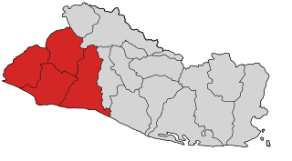
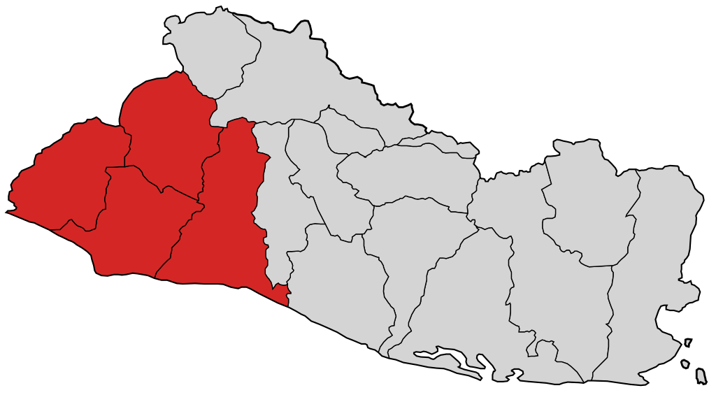
Español: Mapa de las zonas afectadas por el levantamiento campesino en El Salvador en 1932 |
| Date | |
| Source | imagen de dominio público creada por Netito777 e Image:Departments of El Salvador.svg |
| Author | Netito777, vectorizada por Jarke |
| This work has been released into the public domain by its author, Netito777. This applies worldwide. In some countries this may not be legally possible; if so: |
File history
Click on a date/time to view the file as it appeared at that time.
| Date/Time | Thumbnail | Dimensions | User | Comment | |
|---|---|---|---|---|---|
| current | 07:35, 14 June 2007 | | 1,088 × 600 (71 KB) | Jarke | {{Information |Description= {{es|Mapa de las zonas afectadas por el levantamiento campesino en El Salvador en 1932}} |Source= imagen de dominio público creada por {{u|Netito777}} e Image:Departments of El Salvador.svg |Date= 14 Jun 2007 |Author= {{u |
File usage
There are no pages that use this file.
Global file usage
The following other wikis use this file:
- Usage on ar.wikipedia.org
- Usage on ca.wikipedia.org
- Usage on de.wikipedia.org
- Usage on en.wikipedia.org
- Usage on es.wikipedia.org
- Usage on fr.wikipedia.org
- Usage on gl.wikipedia.org
- Usage on it.wikipedia.org
- Usage on no.wikipedia.org
- Usage on pl.wikipedia.org
- Usage on pt.wikipedia.org
- Usage on ru.wikipedia.org
- Usage on tr.wikipedia.org
- Usage on www.wikidata.org
- Usage on zh.wikipedia.org