File:2014-09-29 - Reichsbrücke-Donau City-Sunken City.jpg

Original file(11,962 × 6,200 pixels, file size: 27.13 MB, MIME type: image/jpeg)

Summary

Description
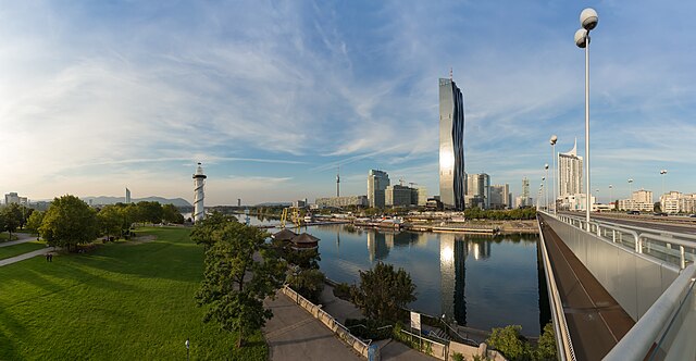
Deutsch: DC-Tower 1, Kaisermühlen - Donau City, Sunken City - Donauinsel - Copa Cagrana - Reichsbrücke, Vienna
English: DC-Tower 1, Kaisermühlen - Donau City, Sunken City - Donauinsel - Copa Cagrana - Reichsbrücke, Vienna
NOTE: This image is a panorama of DC-Tower Vienna consisting of 6 frames that were merged or stitched in Hugin. As a result, this image necessarily underwent some form of digital manipulation. These manipulations may include blending, blurring, cloning, and colour and perspective adjustments. As a result of these adjustments, the image content may be slightly different from reality at the points where multiple images were combined. This manipulation is often required due to lens, perspective, and parallax distortions.

Boarisch | български | dansk | Deutsch | Zazaki | Ελληνικά | English | Canadian English | British English | Esperanto | español | eesti | suomi | français | hrvatski | magyar | italiano | 日本語 | 한국어 | македонски | മലയാളം | Nederlands | polski | português | русский | sicilianu | slovenščina | svenska | Türkçe | українська | العربية | 中文 | +/−

Date
Source Own work
Author

Hubertl

Attribution
(required by the license)
InfoField
© Hubertl / Wikimedia Commons / 
© Hubertl / Wikimedia Commons
Permission
(Reusing this file)
Another one of my pictures:

Want to see more works of mine?
click here
Deutsch: Dieses Foto wurde von Hubertl erstellt und unter nachfolgend aufgeführter Lizenz veröffentlicht. Das Bild kann frei verwendet werden solange der Urheber, die Quelle (Wikimedia Commons) und die Lizenz (CC-BY-SA 4.0) in erkennbarem Zusammenhang mit dem Bild genannt wird.

English: This photograph was taken by Hubertl and released under the license(s) stated below. You are free to use it for any purpose as long as you credit the author, the Source (Wikimedia Commons) and the license (CC-BY-SA 4.0) in close relation to the image.


Belegexemplar erbeten / voucher copy requested hubert.laska[at]gmx.at


This file has been released under a license which is incompatible with Facebook's licensing terms. It is not permitted to upload this file to Facebook.

Please do not upload an updated image here without consultation with the Author. The author would like to make corrections only at his own source. This ensures that the changes are preserved.
Please if you think that any changes should be required, please inform the author.
Otherwise you can upload a new image with a new name. Please use unconditional one of the templates derivative or extract.

Assessments
InfoField
Featured picture
Quality image
Quality image
Valued image
Valued image
This file is marked as a valued image, but it is missing its scope! Please refer to Template:Assessments/doc!

Wikimedia CommonsWikipedia

This is a featured picture' on Wikimedia Commons (Featured pictures) and is considered one of the finest images. See its nomination here.
This is a
Quality image and is considered to meet the Quality image guidelines.
This image has been assessed under the valued image criteria and is considered the most
valued image on Commons within the scope '
.

 This is a featured picture on the German language Wikipedia (Exzellente Bilder) and is considered one of the finest images. See its nomination here.

If you have an image of similar quality that can be published under a suitable copyright license, be sure to upload it, tag it, and nominate it.

Other versions
Location
InfoField
Camera location48° 13′ 55.68″ N, 16° 24′ 43.93″ E Kartographer map based on OpenStreetMap.View this and other nearby images on: OpenStreetMapinfo

Licensing

I, the copyright holder of this work, hereby publish it under the following license:
w:en:Creative Commons
attribution share alike
This file is licensed under the Creative Commons Attribution-Share Alike 4.0 International license.
You are free:
  • to share – to copy, distribute and transmit the work
  • to remix – to adapt the work
Under the following conditions:
  • attribution – You must give appropriate credit, provide a link to the license, and indicate if changes were made. You may do so in any reasonable manner, but not in any way that suggests the licensor endorses you or your use.
  • share alike – If you remix, transform, or build upon the material, you must distribute your contributions under the same or compatible license as the original.
Annotations
InfoField
This image is annotated: View the annotations at Commons

Captions

Add a one-line explanation of what this file represents

Items portrayed in this file

depicts

29 September 2014

48°13'55.67999"N, 16°24'43.93199"E

0.004 second

24 millimetre

image/jpeg

8710ee68e0c985392b8a1ee65e9a8602c9affe17

28,452,916 byte

6,200 pixel

11,962 pixel

File history

Click on a date/time to view the file as it appeared at that time.

Date/TimeThumbnailDimensionsUserComment
current21:40, 10 October 2014Thumbnail for version as of 21:40, 10 October 201411,962 × 6,200 (27.13 MB)HubertlTilted lines straightened.
09:43, 7 October 2014Thumbnail for version as of 09:43, 7 October 201411,962 × 6,200 (27.63 MB)HubertlComplete revision (stitchingproblems solved)
18:55, 1 October 2014Thumbnail for version as of 18:55, 1 October 201411,153 × 5,274 (14.81 MB)Hubertlsome small dustspots removed
12:49, 1 October 2014Thumbnail for version as of 12:49, 1 October 201411,153 × 5,274 (14.73 MB)Hubertl

The following page uses this file:

Global file usage

Metadata